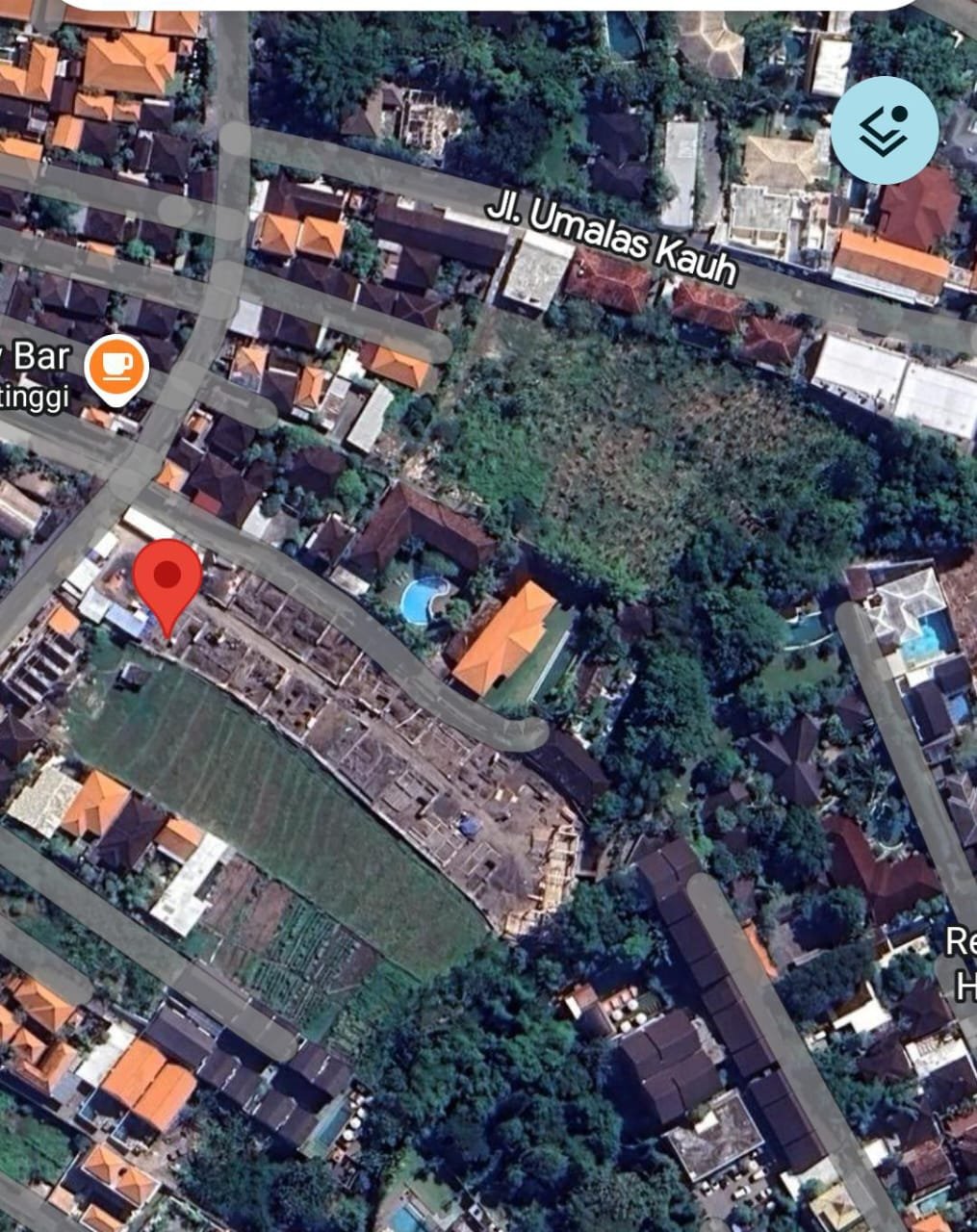
BALINEWSID.COM, BADUNG — A villa construction project in Uma Alas Tunon, North Kuta, Badung Regency, has come under public scrutiny over alleged violations of river setback regulations and concerns about narrowing water flow.
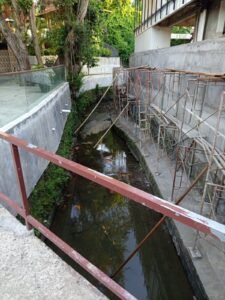
The project, identified as Villa Pandawa Sweet, drew attention after satellite imagery and mapping data indicated that parts of the structure extend into the riverbank area. The development reportedly includes the construction of a crossing bridge, raising concerns about potential disruption to the natural flow of the river.
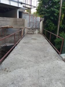
Visual observations show that the construction site spans a relatively ფართ area and remains in progress. At a location marked as “Pura Pejuang,” there are indications that the river channel has narrowed due to building activities situated too close to the water body.
The issue has sparked public reaction and prompted plans for enforcement action by the Public Order Agency (Satpol PP) in the near future. Authorities are expected to assess the site and ensure compliance with spatial planning and environmental protection regulations.
Sources on the ground suggest that the primary alleged violations involve construction within the designated river setback zone and the installation of a bridge without proper adherence to regulatory requirements. Concerns have also been raised that if such violations are later legitimized through the issuance of a Function Worthiness Certificate (SLF), it could set a precedent for tolerance of similar infractions in the future.
The government has established strict rules governing river setback zones under regulations issued by the Ministry of Public Works and Public Housing (PUPR). These provisions are based on Law No. 11 of 1974 on Water Resources, Law No. 23 of 2014 on Regional Government, and Government Regulation No. 35 of 1991 on Rivers.
Under these regulations, river setback boundaries range from a minimum of 10 to 30 meters for unembanked rivers in urban areas, and can extend from 50 to 100 meters in non-urban zones. Utilization of these areas is tightly restricted and permitted only for specific purposes such as water resource infrastructure and public facilities, subject to official authorization.
The primary objective of these setback rules is to preserve the natural function of rivers, prevent channel narrowing, and mitigate disaster risks such as flooding. Authorities have also emphasized that existing structures within setback zones will be subject to gradual enforcement measures.
The case in North Kuta is seen as a test of regulatory enforcement at the local level. The public is encouraged to report similar violations to ensure the protection of water resources and that development proceeds in accordance with applicable laws.


Discussion (0)
No comments yet.