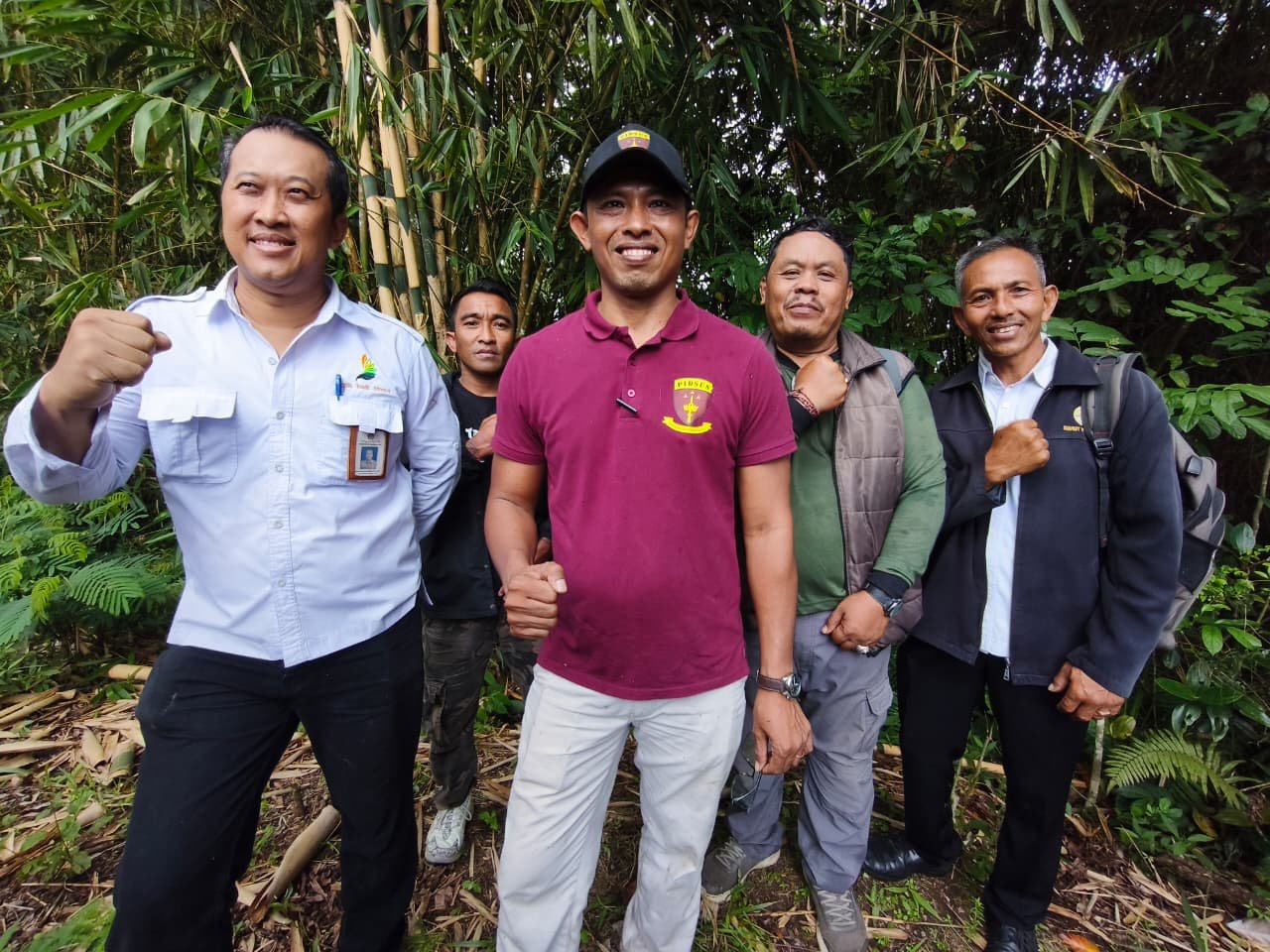
BALINEWS.COM, KARANGASEM — The Bali High Prosecutor’s Office (Kejati Bali) is intensifying its investigation into the alleged land swap (ruilslag) involving mangrove areas linked to the PT Bali Turtle Island Development (BTID) project. After previously conducting inspections in Jembrana, authorities expanded their probe to Karangasem Regency on Wednesday, May 6, 2026, uncovering early findings that have drawn public scrutiny.
A joint investigative team visited the forest area in Banjar Dinas Badeg Dukuh, Sebudi Village, Selat District. The site, claimed to be part of the exchange land, is located on the slopes of Mount Agung, characterized by steep terrain, uphill access, and deep surrounding valleys. Field observations revealed that the land is covered with coffee plants, bamboo, and other forest vegetation, and falls within a state forest area managed by the East Bali Forest Management Unit (KPH Bali Timur).
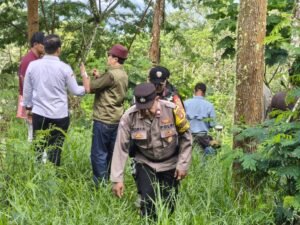
The investigation involves multiple agencies, including the Bali National Land Agency (BPN), the Forest Area Consolidation Agency (BPKH), KPH Bali Timur, and the Bali Provincial Forestry and Environment Office, to verify the land’s legal status.
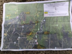
Data from the Karangasem Land Office indicates that the total land involved in the swap reaches approximately 40.2 hectares. Around 12 hectares are located in Sebudi Village across three plots, while the remaining 30 hectares are spread across four plots in Kubu District.
Preliminary findings show that the exchange land lies about 3 kilometers from the slopes of Mount Agung and is part of a state forest zone. This has raised public concerns over potential irregularities in the land swap process, particularly suspicions that state-owned forest land may have been used as an exchange object.
Head of Operational Control for Special Crimes at Kejati Bali, Anak Agung Ngurah Jayalantara, stated that investigators are still collecting data to confirm the land’s origin and legal status.
“Our goal is to avoid errors in legal analysis, both in terms of land size and status. We are still examining whether the land originates from private ownership certificates (SHM), conversion, or other forms,” he said.
He added that the investigation is complex due to previously unsynchronized forest boundary data, requiring cross-agency verification and direct field measurements.
The case is part of a broader investigation involving 106 land certificates, with mangrove areas tied to the BTID project classified under Green Open Space (RTH) category 10.
“If violations are found, we will proceed according to the law. Otherwise, we will present the findings objectively. Our principle is to seek the truth,” Jayalantara emphasized.
Meanwhile, Head of the Karangasem Land Office, I Made Arya Sanjaya, explained that his office is conducting measurements to determine the exact location and legal status of the exchanged land.
“We need to verify in detail whether the land is already certified and understand its ownership history,” he said.
Preliminary results indicate that no land certificates under PT BTID’s name have been found at the location. He also stressed that land swaps involving forest areas fall under the authority of forestry institutions, not the National Land Agency.
“If the land is part of a forest area, the exchange mechanism is handled by forestry authorities. BPN does not register it like ordinary land rights,” he clarified.
As of now, all measurement and identification processes are ongoing and will form the basis for Kejati Bali’s legal analysis in determining the next steps. The investigation is expected to clarify the legal status and legitimacy of the land swap, which remains under public attention.


")

Discussion (0)
No comments yet.