
BALINEWSID.COM, TANGERANG SELATAN — Indonesia’s satellite development capabilities have continued to advance, evolving from experimental satellites designed primarily for Earth observation into technologies supporting communications, disaster mitigation, vessel monitoring and remote-sensing data.
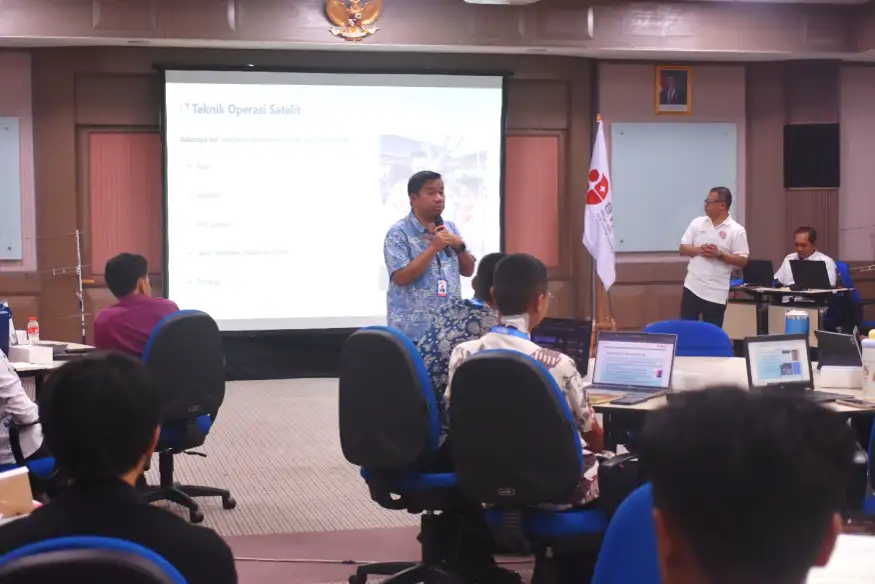
The development was introduced to students through the Indonesia Research and Innovation Fair (IRIFair) 2026 Aerospace Talent School at the B.J. Habibie Science and Technology Center in Serpong, South Tangerang, on Wednesday (Sept. 23).
Rifki Ardinal, a first-level expert engineer at the National Research and Innovation Agency’s (BRIN) Satellite Technology Research Center, said Indonesia’s progress in satellite technology could be seen through the development of LAPAN-A1, LAPAN-A2 and LAPAN-A3. The development has now continued with the Nusantara Earth Observation-1 (NEO-1), which has entered the testing and integration stage.
“LAPAN-A1 was the first-generation experimental satellite developed by Indonesian researchers in cooperation with the Technical University of Berlin,” Rifki said.
LAPAN-A1 operates in a polar orbit and was primarily designed for Earth observation. The satellite passes over Indonesian territory approximately four to six times a day.
The development of Indonesia’s satellite technology then continued with LAPAN-A2, a second-generation experimental satellite developed in cooperation with the Indonesian Amateur Radio Organization (ORARI). The satellite was designed and built entirely in Indonesia.
LAPAN-A2 was launched from India on Sept. 28, 2015. It carries several missions, including Earth observation using a spacecam, disaster mitigation through a voice repeater (VR) payload and an Automatic Packet Reporting System (APRS), as well as vessel monitoring through an Automatic Identification System (AIS).
Indonesia subsequently developed LAPAN-A3 in cooperation with the Bogor Agricultural University (IPB). The satellite was launched on June 22, 2016, and carries an AIS mission with a broader, global-scale data coverage.
LAPAN-A3 is also equipped with a multispectral camera for vegetation monitoring, a spacecam for Earth observation and a magnetometer to monitor the Earth’s magnetic field.
The three satellites are controlled through several BRIN ground stations, including facilities in Rancabungur, Bogor; Kototabang, West Sumatra; Parepare, South Sulawesi; and Biak, Papua.
Indonesia’s satellite development has now progressed to NEO-1. Rifki said the satellite had entered the testing and integration phase.
NEO-1’s main mission is Earth observation through the provision of high- and medium-resolution satellite imagery. The data can be used for regional mapping, agricultural and forestry monitoring, environmental monitoring, disaster mitigation and vessel activity monitoring through AIS.
“NEO-1’s main mission is Earth observation through the provision of high- and medium-resolution satellite imagery,” Rifki said.
He added that the development of NEO-1 was part of BRIN’s efforts to strengthen Indonesia’s national satellite technology capabilities and expand the use of remote-sensing data to support development needs across the country.
Students Practice Satellite Communications
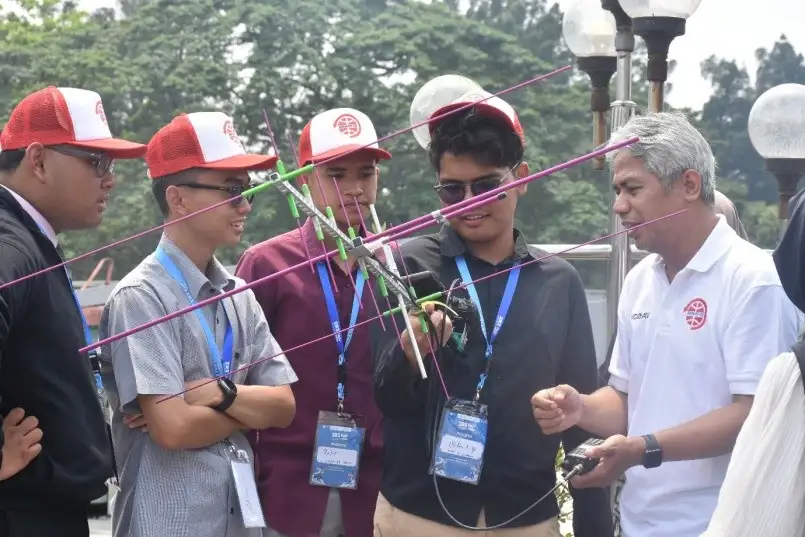
Beyond introducing the development of satellite technology, BRIN also gave students an opportunity to learn and practice satellite-based communication using LAPAN-A2, also known as IO-86.
Muhammad Yasir Zain, president of Amateur Satellite Indonesia (AMSAT-ID), introduced participants to basic satellite concepts, including orbit, footprint, azimuth and elevation, before they took part in communication exercises using handheld transceivers (HTs) and simple antennas.
Yasir explained that satellite trajectory planning needs to take geographical coverage into account so that signals can reach different parts of Indonesia.
The participants then applied the concepts during radio communication exercises, including communicating with participants in different regions along the satellite’s trajectory.
Before the exercise, participants were also introduced to the rules governing the use of call signs. Yasir emphasized that satellite-based radio communication must comply with licensing requirements and use official call signs.
Azimuth and elevation are also important terms in tracking a satellite’s position. Azimuth refers to the antenna’s direction, while elevation refers to the antenna’s angle above the horizon.
Satellite movements can be monitored through tracking applications that display the satellite’s position based on predicted trajectories. The applications also show Acquisition of Signal (AOS), which indicates when a satellite’s signal can first be received by a ground station.
Yasir said satellites generally experience tumbling, or uncontrolled rotation, while orbiting Earth. As a result, the satellite’s antenna may not always point directly toward a ground station, potentially causing signal fading.
Circularly polarized antennas can be used to help maintain communication quality under such conditions.
According to Yasir, satellite communication can be carried out using relatively simple and affordable equipment. The LAPAN-A2 or IO-86 voice repeater can be accessed using a standard HT with a transmission power of 5 watts, while antennas can be made from simple materials such as wire hangers or clothesline wire.
“The LAPAN-A2 or IO-86 satellite is equipped with a voice repeater that can be accessed using a standard HT with a transmission power of 5 watts and a range of more than 4,500 kilometers,” Yasir said.
The system allows amateur radio operators in Indonesia to communicate with users in other countries, including Malaysia, the Philippines, Thailand, Sri Lanka, Japan and China.
IO-86 can also be used for APRS at 145.825 MHz, while its voice repeater operates at 145.880 MHz for the uplink and 435.880 MHz for the downlink.
Through the IRIFair 2026 program, BRIN introduced students to satellite technology not only as a field involving the launch and operation of spacecraft, but also as a technology supporting communications, Earth observation, disaster mitigation, environmental monitoring and the use of data for development in Indonesia.




Discussion (0)
No comments yet.